Vehloc: Hybrid Positioning
A resilient positioning system that overcomes
limited GNSS coverage and signal jamming
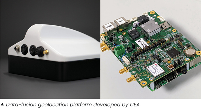
This CEA-Leti technology ensures uninterrupted positioning to within 10 centimeters, even if the GNSS signal is disrupted. When the GNSS receiver fails to pick up a signal, data fusion algorithms developed by CEA-Leti allow other sensors to take over seamlessly.
The solution combines an RTK (real-time kinematics) GNSS receiver with centimeter accuracy, inertial sensors, odometers and - this solution’s main innovation - an embedded ultra-wideband (UWB) radio combined with ground stations that calculate the vehicle's position. This system paves the way for resilient, uninterrupted positioning in crowded or disturbed environments.
What it can do
This solution can be deployed in a variety of use cases: - Autonomous vehicles: Extending autonomous driving in urban canyons.
- Public works: Geolocating radar images of underground networks or inspection robots in underground pipes.
- Defense & security: Bypassing GNSS jamming to locate vehicles in military theaters of operation.
- Drones: Overcoming the loss of GNSS signal during structural inspection.
- Logistics: Locating forklifts and personnel in warehouses to optimize routes and avoid collisions.
- Cable transport: Locating cable cars.
|
|
What makes it unique
The integration of UWB radio and data fusion enhanced by advanced algorithms enables uninterrupted and resilient positioning with unrivaled accuracy in challenging environments like urban canyons, underground networks, tunnels, warehouses, and military theaters of operation. Compact, low-power Vehloc ground stations provide local-satellite-like coverage, bringing UWB measurements to multi-sensor fusion, for precise, continuous positioning. This flexible solution is compatible with a wide range of sensors, from the simplest to the most sophisticated. Each component can be selected individually to achieve the best cost-performance tradeoff for the target use case. |
Credits: C.VILLIEN-CEA
Working with CEA-Leti
Location and positioning system component suppliers, sub-system suppliers, integrators, and industrial end-users can work with CEA-Leti to develop this technology for specific use cases. CEA-Leti brings its partners expertise in modeling all the technologies in the system, as well as a deep understanding of the entire data processing chain, from sensor to final calculation of the object’s position. Several types of partnerships are available to ensure support through to transfer of the solution developed.
This technology has been transferred to construction-industry leader Colas for the geolocation of GPR images. It has also been developed for the positioning of autonomous vehicles in urban environments as part of the European iExoddus project.
Scientific publication
-
Villien, C., Denis, B. (2023). UWB-aided GNSS/INS fusion for resilient positioning in GNSS challenged environments. IEEE/ION PLANS, pp.167-178.
|